
Esri India will provide training support to BEL to help build in-house capabilities in GIS and GeoAI using its Indo ArcGIS platform.
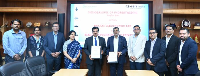
Esri India has signed a Memorandum of Understanding (MoU) with Bharat Electronics Limited (BEL) to collaborate on defence projects involving Geographic Information Systems (GIS), location intelligence, and GeoAI technologies.
BEL, a Navratna public sector enterprise under the Ministry of Defence, and Esri India have previously worked together on projects for the Indian defence services. The new agreement is intended to expand that collaboration and support future defence programs.
Under the MoU, the two organisations will jointly pursue opportunities in the defence sector by combining BEL’s expertise in defence electronics and systems integration with Esri India’s capabilities in GIS, location intelligence, and GeoAI. They will also work together to ensure timely deployment of GIS solutions for operational requirements across defence initiatives in India.
As part of the collaboration, Esri India will provide training support to BEL to help build in-house capabilities in GIS and GeoAI using its Indo ArcGIS platform.
Agendra Kumar, Managing Director of Esri India, said that geospatial intelligence has become a strategic decision-making advantage in defence, enabling faster and more precise analysis and response. He added that the integration of GIS and GeoAI will play an increasingly important role in building resilient and mission-ready defence capabilities, and that the collaboration with BEL is aimed at strengthening indigenous geospatial innovation in line with the vision of Atmanirbhar Bharat.
The agreement is aligned with the Government of India’s Make in India initiative, with both organisations committing to leverage indigenous capabilities and technology sharing to address the needs of the country’s defence establishment.
Rajnish Sharma, Director (BC) and Additional Charge Director (Marketing) at BEL, said that the partnership combines BEL’s experience in defence systems with Esri India’s leadership in GIS to develop next-generation geospatial solutions that can provide defence forces with actionable intelligence, improved operational coordination, and enhanced situational awareness.